The Massasauga is well worth exploring

By Rear Commodore David Spencer
Ontario is blessed with an abundance of natural beauty, and the best places to enjoy it (other than aboard your cruising boat) are in Ontario's provincial parks.
Fully 8 percent of Ontario’s landmass is taken up by 330 provincial parks, spanning about 82,000 square kilometers (31,600 square miles). Some parks are enormous, such as Algonquin, Polar Bear Provincial Park in the far north, and Quetico on the Ontario / Minnesota border. Some are tiny, such as Darlington that abuts the city of Oshawa, home to 420,000 people. Some provincial parks attract more than 1 million visitors a year. Some are undeveloped wildernesses attracting little more than beavers, bears and butterflies.
Ontario’s provincial parks offer more than 19,000 car-accessible campsites and 8,000 wilderness sites spread across a system used annually by 13.6 million Ontarians and visitors.
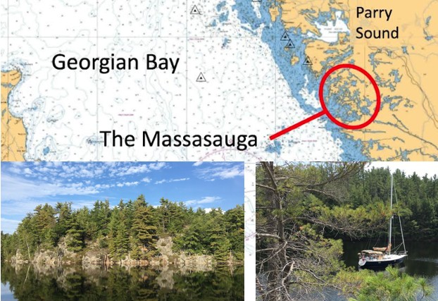
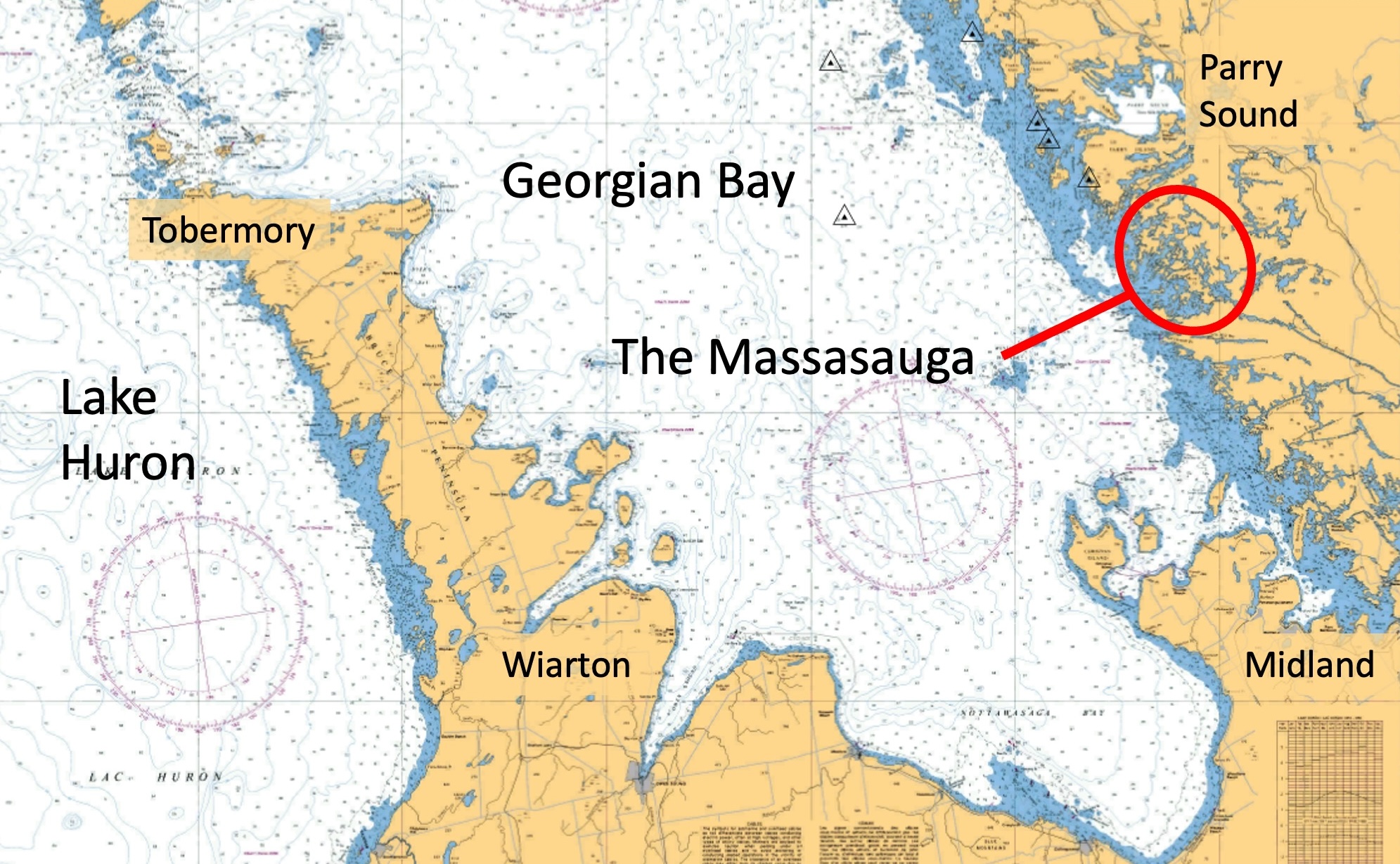
But there is nothing like The Massasauga Provincial Park. The Massasauga is nestled among the Thirty Thousand Islands, occupying 131 square kilometers (over 50 square miles) of Georgian Bay shoreline between Parry Sound and the Moon River near Twelve Mile Bay.
The park wasn’t created until 1989 and by that time, many of the attractive islands within the park boundary were already occupied by private summer homes, many dating back more than 100 years. Instead of expropriating the private land, the park left the occupied property in private hands but protected the surrounding wilderness area and the maze of waterways deep enough for cruising boats. The park established 135 canoe access wilderness campsites and waterways linked by well-marked portages.
The Massasauga was initially somewhat unfriendly to cruising boaters. In the 1990s, the park tried to charge a fee for anchoring. However, in a legal challenge, the court found the fees to be unconstitutional since waterways are under federal jurisdiction in Canada and anchoring must not be subject to provincial park fees.
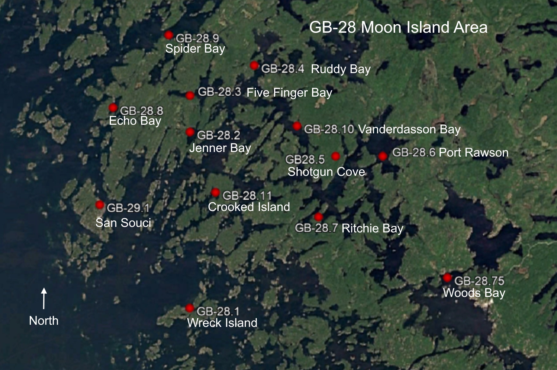
The GLCC’s Harbor Reports predate the park’s founding in 1989, so the GB-28.X series of reports is called the Moon Island Area instead of The Massasauga. (Maybe we’ll change that soon.)
Potential Massasauga cruisers should study GB-28 through to GB-28.11. The detail provided in the GLCC Harbor Reports for The Massasauga’s anchorages is excellent. A copy of CHS chart 2202 Sheets 3 and 5 is also useful to understand this geographically complex area full of fantastic anchorages.
There are only a couple of floating navigation buoys in The Massasauga, but there are lots of daymarks on the shore to keep cruisers heading safely in the right direction. Despite the lack of buoys, navigation is surprisingly easy, even in the relatively narrow main passages of The Massasauga with deep water and only a few unbuoyed hazards that are well-charted and often privately marked by cottagers with bleach bottles.
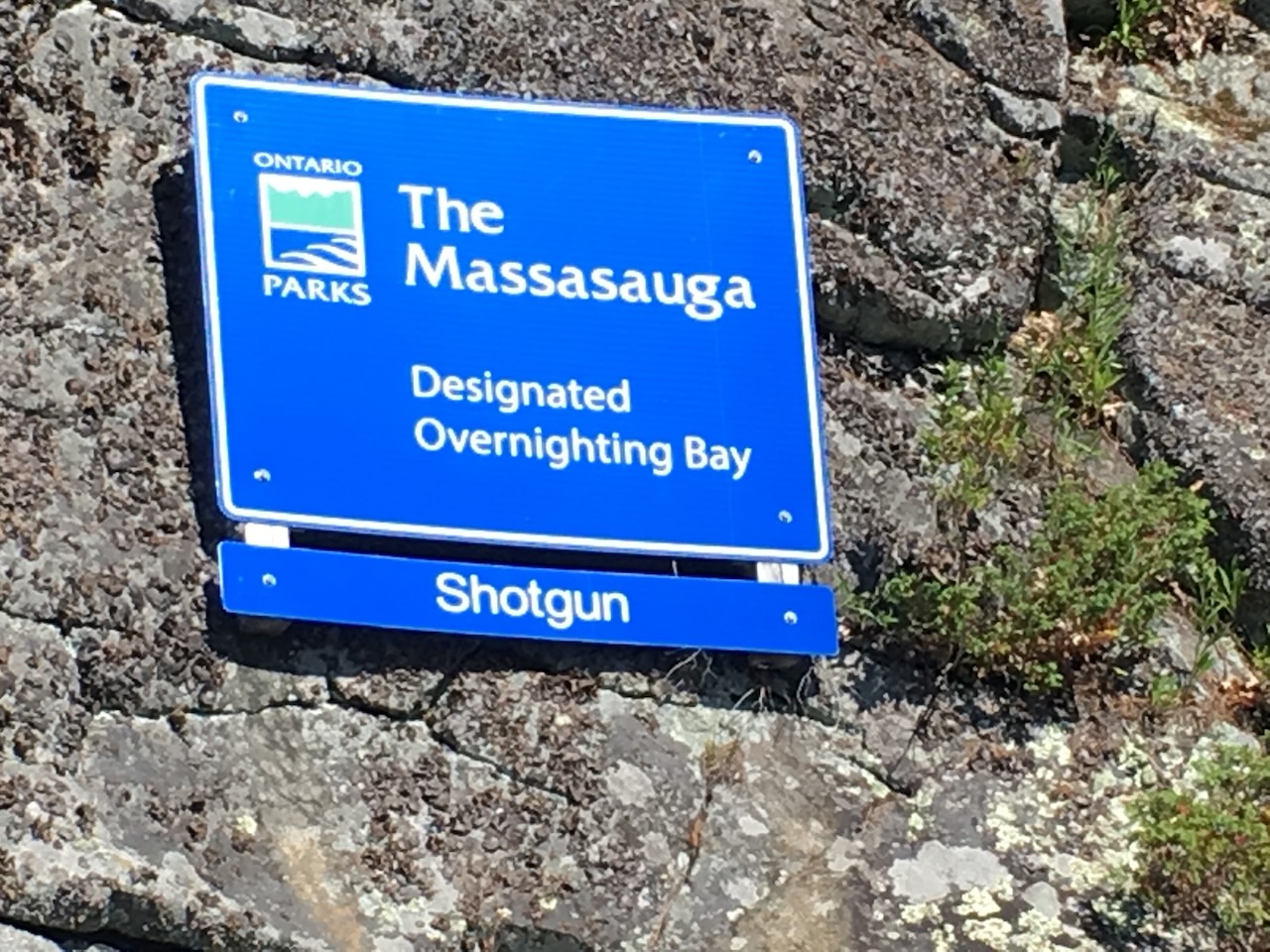
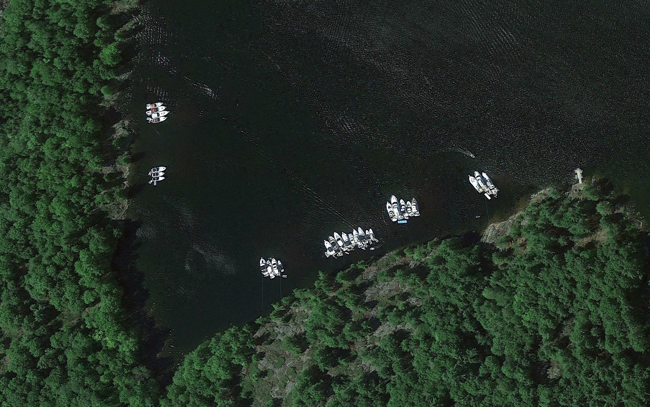
The park has established numerous “Designated Overnighting Bays” set aside for cruising boaters. These anchorages are marked by signage in the park and are described in the GLCC Harbor Reports but are not shown on navigation charts. They are located away from private cottages. They are generally as far away from the 135 wilderness campsites as is practical, offering lovely scenic views, peaceful surroundings and good protection from most weather.
The Massasauga has three entry routes described in Harbor Report GB 28. The only one a cruiser needs to explore 90 percent of The Massasauga’s anchorages is “The Northern Entrance.” The Middle and Southern entrances described in GB-28 are fun passages to explore, but they are complex routes leading to only a limited assortment of anchoring opportunities.
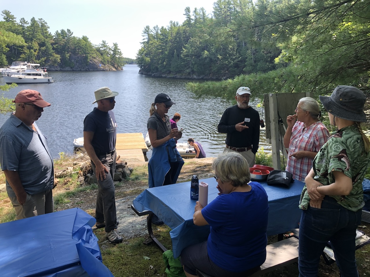
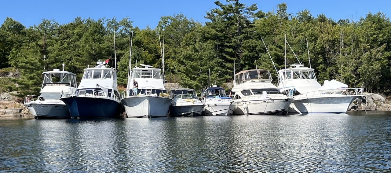
Most designated overnighting bays have a “boaters gathering” area ashore with a dinghy dock, picnic table and fire pit. The dinghy docks visited over the past several years are all in good repair, with most of them renewed in 2021 and 2022. These are great places to socialize with others anchored nearby for shared dinners and happy hours.
Bring your own firewood. Scavenging of branches for firewood, even dead branches, is not permitted in provincial parks. Pick up trash and return it to your boat. There are no trash bins at the boater gathering areas.
There are loads of anchorages in The Massasauga. You could explore this area for the entire summer and never be bored with the variety of lovely places to drop the hook. We will look at only a few: Echo Bay, Port Rawson and Shotgun Cove.
Echo Bay GB-28.8
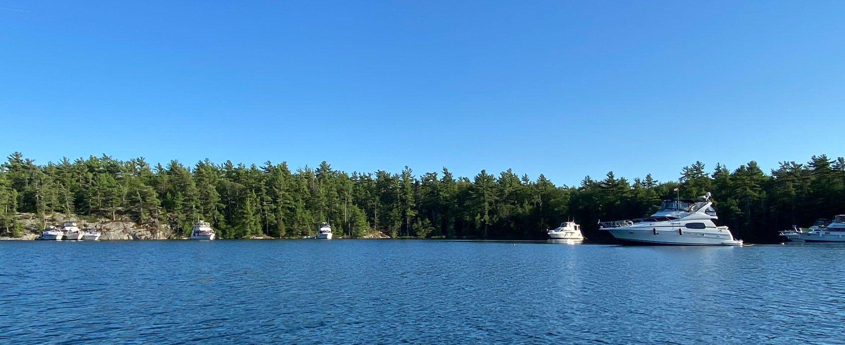
Echo Bay is likely the most popular anchorage in The Massasauga. It’s only half a nautical mile off the small craft route and is a fine place to anchor without going too far out of your way if you are making miles along the small-craft route heading north.

If you’re anchored in Echo Bay, it’s only 1.5 nautical miles by dinghy to Henry’s for lunch or dinner. Just don’t try it on a Monday, or you’ll go home hungry since they’re closed Mondays, and they serve their last meal of the summer on Labour Day Sunday. If you don’t want to anchor, Henry’s has overnighting docks for cruising boats that are particularly popular with Loopers.
 Echo Bay is well-hidden through a narrow but adequately deep channel south of Echo Island opening up to the inviting south anchorage to starboard. Before hauling to starboard and picking your spot for the night, you will see a tempting bay north of the entrance channel to port. The nasty bank of boulders blocking the entrance to the north bay will discourage most cruisers.
GLCC members benefit from those who blazed a trail years before. The Echo Bay Harbor Report includes a sketch showing a narrow slot 5½-feet deep at datum that will allow all but the largest cruising boat to wriggle in and enjoy the north anchorage of Echo Bay. If you’ve made it into the north anchorage, be cautioned that when water depths are adequate, some cottage PWCs like to zip through the shallow passage north of Echo Island and run through the anchorage.
Echo Bay is a nice place, but I consider it to be only an entry-level anchorage for The Massasauga. To enjoy the riches of this area, depart the small craft route and take the dotted-line passage east of Frying Pan Island, through the narrow passage at Anker Pint to the numerous anchorages well away from the small-craft route.
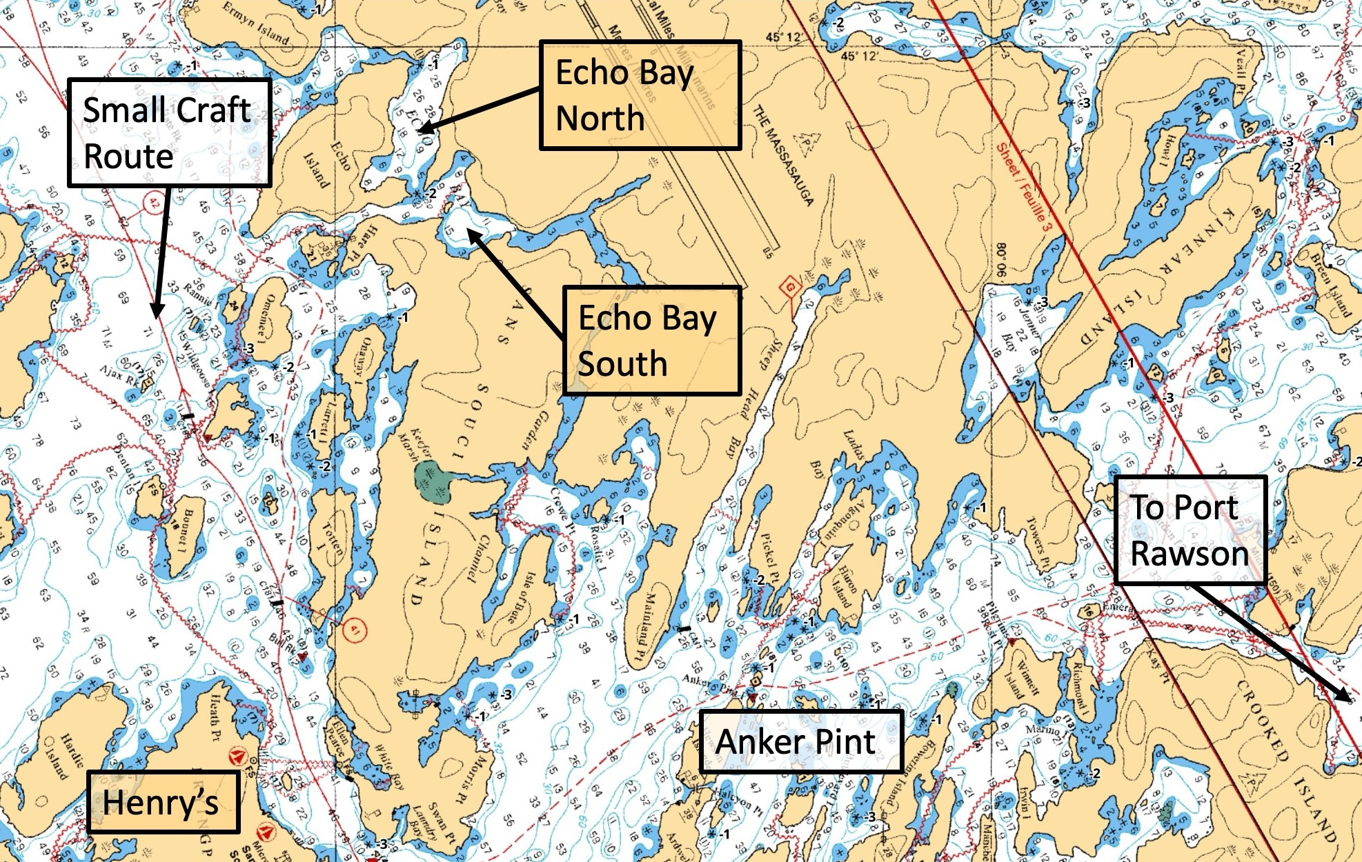
Port Rawson GB-28.6
Port Rawson is an enormous anchorage about 5½ nautical miles off the small craft route. Since it’s called “Port” Rawson, you may expect such “port” services as fuel, provisioning or road access to be available. Certainly not! There are no services for many miles around although a 5 nautical mile dinghy ride through the unsounded Woods Bay (GB 28.75) will take you to Woods Bay Marina which primarily services the island cottage population in the area.
Because it’s large enough to accommodate many boats in several different spots, it’s a popular place for marina and boating club rallies.
Anchorages can’t be reserved in The Massasauga, but there will always be enough room for your group at Port Rawson. One marina in southern Georgian Bay is legendary for delivering several dozen pizzas to their rallies via float plane. There are a couple of wilderness campsites along the shoreline, so try to anchor as far away as possible so both boaters and campers can enjoy their activities in peace and privacy.
Shotgun Cove GB-28.5
If Port Rawson is busy with a couple of raft-ups, or you’re looking for quiet, Shotgun Cove is a perfectly protected and attractive anchorage only about a half nautical mile from Port Rawson. At the narrow entrance, favour the cliff on the east side to avoid the 3-foot sounding on the west side.
Once inside, you can anchor anywhere. There are no hidden obstructions or surprises. The cove gently shallows as you approach the north end. A dozen boats can easily anchor here without anyone feeling crowded.
If you are anchored among boaters that you haven’t met yet, hop in your dinghy and tour the anchorage. Invite everyone nearby for an informal social meet at the boaters’ gathering area. You’ll likely meet a new friend and share insights about the wonderful anchorages of The Massasauga and beyond. If you promote GLCC membership, all the better.
Most cell signals are blocked by the area’s rock formations so you won't be distracted by your phone ringing or your email dinging. If you really need a signal, a cruise in the dinghy to nearby open water or a brief hike to a high point on land will likely result in a signal strong enough to send and receive a couple of messages, but not strong enough to get you lost in the day’s digital trivia.
Being out of touch here is a feature, not a defect. It’s wonderful to get lost in The Massasauga.