New Cruise Book - Chicago to Paducah

 A good new cruise book is available, of interest to members who are planning the Great Loop from the Great Lakes. It's volume 1 of the Managing the Waterway Chart Guides, covering the Loop from Chicago, down the Illinois River to the Mississippi and up the Ohio to Paducah, Kentucky, and the start of the Tenn-Tom waterway.
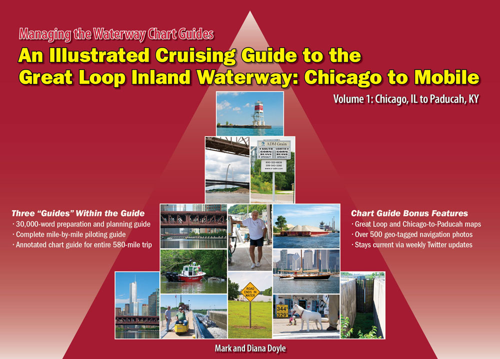
The book is large (13” by 18” in “landscape” orientation) and spiral bound. The main part of the book includes charts of the river, with text and photos alongside, keyed to spots on the chart. Useful information includes mileage markers, dockage, anchorages, bridge heights, towns, locks, and navigation info (like “caution: extremely long and shallow sand spit”). There's a “heads up” section on each page, highlighting piloting concerns (like “Lock Ahead,” and “Fuel Alert,” and “No Anchoring”). The information seems fairly complete—at least as good as any other cruising guide to the area.
The beginning of the book is a 30,000-word preparation and planning guide, about what to expect on the passage, including such things as how and where to unstep the mast, bridge heights, locking procedure, dealing with barge tows, and so on. It's comparable in quality to the other cruise guides for the Great Loop.
The big advantage of the new book is that it is in full color, particularly desirable in viewing the charts and the photos. The other advantage is the “tagging” of text and photos to spots on the chart, so the cruiser can have all the information right at hand. The full-color and the tagging make this the best cruising guide now available for this section of the Loop.
You can also subscribe to free weekly electronic updates to the book, getting them by e-mail, tweets, or RSS feeds.
Authors (and publishers) are Mark and Diana Doyle, from Eden Prairie, Minnesota.
The company's next publication in this large, full-color format is the second section of the loop, from Paducah to Mobile. Publication date is not set yet—the authors say they are waiting to see the reception of this new format before going to press with the second volume.
The company also produces cruising guides to the rest of the loop, but these are in their older, black-and-white, smaller conventional format.
They also produce “e-charting bundles,” which are basically all available NOAA (coastal) and U.S. Army Corps of Engineers (inland waterway) raster and vector charts for the entire Loop. In addition, the DVDs include a nautical library of searchable government publications, reference texts, and nautical calculators (Bowditch, Light Lists, Chart 1, etc.), as well as free and trial versions of PC and Mac charting and navigation applications. There are approximately 3,000 charts and 200 publications on the DVDs. Of course, these are all free publications that anyone can download, so they are basically doing the downloading, cataloging, and DVD-burning for you.
The new full-color book is $39.95, the “e-charting” DVDs is $24.95. You order through their web site: https://www.onthewaterchartguides.com/
A second new book is the NYS Canal Reference, by John Pfund and Jean Taber. This is a “supplement” rather than a cruising guide to the Erie Canal. Its feature is a series of color photographs of places along the canal. The photos are good and useful, probably worthwhile as an accompaniment to the GLCC harbor report (W-13) and the official guides of the New York State Canal Corporation. Unfortunately, it covers the Canal only from Oswego, NY, to Kingston on the Hudson—the western section to Buffalo is not covered. Available from the publishers (Jean Taber, 5437 Gates Dr., Williamson, NY 14589), for $39.